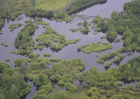
Are forests to blame for the June flood in the Irkutsk Region?
15 July 2019 г.

According to experts, the flood in the Irkutsk region was caused by a rare combination of natural factors: collision of air masses, strong influx of heat and moisture, which reached the Eastern Sayan and resulted in heavy rains, and fast melting of glaciers. Thus, according to the data of the Irkutsk State University, in the Tulun region fr om June 25 to June 27, there was a record amount of precipitation — almost four times higher than the normal one.
Nevertheless, the media present emphatic opinions that the situation was affected by the number and condition of forests in the water basins of the Uda and Iya rivers, the city of Tulun being located below these rivers. This judgment is questionable, since the main cuttings are located to the north of the settlements which happened to be in the flood zone, that is, downstream the rivers. The upper reaches of the River Iya, like many other tributaries of the Uda and Kana rivers, are located in the high-mountainous regions of the Eastern Sayan. These areas are virtually inaccessible for forest management. For comprehensive analysis of the causes of flooding, reliable information is needed about forests, precipitation, melting of snowfields and river channel processes: destruction of natural or artificial barrages upstream, and congestion formations downstream.
The forests in the river catchment area, of course, perform important water regulatory and water protective functions. Forest vegetation softens the flood peaks due to the interception of precipitation and transfer of surface water into the soil. Due to this, the peaks of floods and their waves are extended in time. However, this water regulatory effect is the most pronounced in small watersheds of up to several square kilometers. In large watersheds, the water regulating role of forests is reduced. Here, a much larger number of factors affects the behavior of the water flows.
“It is important to take into account how open the river basin is as compared to the moisture-carrying masses, what landscape zones the river comes across, how its tributaries are located, and how much their flow is regulated. There is a high probability that the smoothed flood peaks formed on a small forest watershed, located upstream from a large settlement, can reach the location simultaneously, and so the flood does not depend on the forest cover, ” says a senior research associate of the laboratory of technogenic forest ecosystems at the V.N.Sukachev institute of Forest, Candidate of Agricultural Sciences, Tamara Burenina.
Hydrologists recognize the water protective and water regulatory role of the forests, but the question remains whether the logging affects flooding. The catastrophic floods in Thailand and Bangladesh in 1988 were considered to be due to deforestation on the slopes of the Himalayan mountains. On the other hand, there is a sufficient amount of scientific studies revealing no connection between deforestation in watersheds and floods. A number of scientific studies show that the transition of forest areas to grass lands as a result of logging or fires leads to the flood peaks at the local level, but it is not the main cause of high floods.
The conclusions made by the Center for International Forestry Studies based on long-term observations show that forests cannot prevent catastrophic floods caused by meteorological phenomena.
To estimate the role of forests in controlling floods on a river, it is necessary to use forest hydrological models adapted to local and regional conditions. Unfortunately, research in Russia which could be the basis for creating such models has been reduced to a minimum. The knowledge and data accumulated by forest hydrologists in the USSR is not enough nowadays to understand the hydrological role of forests under the current conditions of climate change and increasing human impact.
There is an overlook on the part of different scientific foundations, which in recent years, if not decades, have not supported a single project on this topic. This state of affairs allows amateurs to draw far-reaching conclusions that deforestation is the main cause of flooding. To be objective, it is necessary to point out that we can currently observe many negative phenomena in the forest industry, but it is incorrect to “hang all dogs” on forestry, which is in deep crisis.
Of course, deforestation does not lead to the floods reduction, but the negative contribution of this factor in this case cannot be objectively estimated. Mitigation of problems related to emergency situations can be achieved by studying the nature of such phenomena, verifying mathematical models and adapting them to regional and local conditions.
“It is necessary to carry out systematic work on an ongoing basis with close cooperation between science, government and all the constituent entities interested in solving problems of emergency situations. The mountainous regions of Southern Siberia, wh ere the flows of almost all large rivers are formed, require regular monitoring of precipitation. In the last two or three decades, a sufficiently large number of meteorological stations and hydrological stations were closed in the mountains, ”comments the director of the V. N. Sukachev Institute of Forest, Doctor of Biological Sciences, Alexander Onuchin.
It is obvious that the measures taken by forest protection services in Russia, including the watershed areas, are not enough to preserve the water protective functions of forests. Before, a number of studies were conducted aimed at determining the optimal forest cover of watersheds in various forest growing conditions, and at identifying the optimal width of water protective forest belts. Unfortunately, their results are not consistently reflected in legal acts regulating forest use. Developing and meeting such requirements will contribute to the conservation of water resources and formation of favorable natural environment in taiga regions.
Natalia Kuzmik, Candidate of Agricultural Sciences, Scientific Secretary of the V. N. Sukachev Institute of Forest, Krasnoyarsk Science Center SB RAS
Share:
