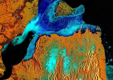
"Macroscope" for the Earth: How Scientists Explore the Planet Surface from Space
12 May 2021 г. FRC KSC SB RAS

FOREST FIRE PREVENTION
Oleg Yakubailik, Candidate of Physical and Mathematical Sciences, Head of the Laboratory of Space Systems and Technologies of the Federal Research Center of KSC SB RAS, tells how Krasnoyarsk scientists are monitoring forest fires using satellite data.
Satellites transmit data obtained from surveying the earth's surface in various spectral ranges: visible, ultraviolet and infrared. Infrared radiation, or as it is also called, thermal radiation, is of particular importance for fire detection. It clearly records areas with elevated temperatures. Based on these data, scientists can find out whether a jump in temperature is actually associated with a fire.
After processing the primary spectral images, the researchers obtain such information as spectral indices. In particular, the aerosol index makes it possible to estimate the amount of dust and particles in the atmosphere and to track the smoke content in the region. Satellite images clearly show events on a scale of several thousand kilometers, when smoke from fires in Evenkia reaches Krasnoyarsk or cities in the European part of Russia.
To analyze the effect of fires on the taiga, they are monitored in real time. An important component is the post-fire images of burns. With their help, it is possible to accurately estimate the burnout areas . Images taken in different spectral ranges make it possible to detect the presence of a fire years after the fire itself. Visually, such a land area may already be "green", being overgrown with grass and shrubs. Using satellite data, scientists also track the success and timing of reforestation. For example, in one of the latest studies using remote sensing data of the earth, scientists show that reforestation in Siberian regions takes decades.
Today, the main attention of scientists is focused on the long-term features of the distribution of forest fires rather than on their individual cases. Having long-term statistics, it is possible to identify the most fire-hazardous season or area which needs attention. Such information will help prevent catastrophic situations. For example, knowing that in a certain area there is a high probability of fire in a definite period of time, recommendations concerning special measures to be taken can be formulated to minimize the consequences. Analysis of long-term data allows one to influence the efficiency of measures related to the extinguishing of fires and minimization of damage.
HARVESTING ON TIME
Remote sensing opens up opportunities for farmers which were previously unavailable. Anatoly Shevyrnogov, Doctor of Technical Sciences, Professor, Head of the Laboratory of Environmental Informatics at the Institute of Biophysics, KSC SB RAS, tells how satellite data are used for early forecast of grain yield.
The idea of early yield forecasting using remote sensing is based on measuring the spectral reflectivity of crops during the growing season. The data obtained show how the amount of photosynthetic pigments in plants changes. Data used in this work is taken both from satellites and drones. Each of these methods has its own limitations. The quality of satellite images depends on the weather and transparency of the atmosphere while drones have limited shooting range. Combining the two methods, one can get accurate information, both for large areas and for local ones.
The reflectivity of plants is related to their state and their response to changes in the environment such as drought, late spring, or pests. All of these factors affect the amount of light reflected by plants. It is recorded using a satellite or an unmanned aerial vehicle. In the course of research, scientists have noticed that the values of the reflection spectra are associated with the yield at the end of the growing season. It is worth clarifying that a one-time measurement of the spectrum is not very informative. In order to obtain a reliable forecast of yield, it is necessary to monitor the variability of plants, especially in the first half of the growing season.
Another promising use of remote sensing in agriculture is the calculation of the volume of foliar feeding of plants. The introduction of minerals and vitamins into the soil can be carried out many times during one growing season. At the same time, the cost of fertilizers is quite high. In order not to waste money and effort, one can receive data from a satellite or drone which will show problem areas which need "help". This approach of increased attention to certain areas will significantly save resources.
Yield prediction allows one to assess logistic and management decisions, for example, concerning the distribution of the crop depending on its quantity and economic situation. It is a “look into the future”, ensuring food security. Differentiated fertilization is also economically justified. It is necessary to carry out work on the determination and analysis of the reflectivity of plants so that agricultural sector could use its resources more efficiently.
Share:
