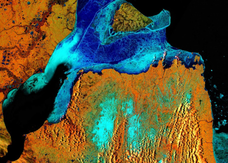
Krasnoyarsk scientists: it is possible to monitor the state of Arctic soil from space
6 March 2020 г.

To study the inaccessible regions of the Far North and Arctic, satellite observation data can be used. The main task of specialists in the field of remote sensing of the Earth is to develop algorithms which would analyze the collected data and convert them into understandable and valuable information. Until recently, there have been no models for the soil analysis in the permafrost zone, which complicates the study and development of the Arctic areas.
Scientists of the Federal Research Center “Krasnoyarsk Science Center” SB RAS have created a model for characterizing frozen Arctic soils using satellite systems. The algorithm is based on the measurement of complex dielectric constant and it is designed for thawed and frozen mineral soils. Using this algorithm, it is possible to track the temperature, humidity and condition of the surface permafrost.
To build the model, soil samples collected in the Arctic tundra of the Yamal Peninsula were used. To select the exact parameters, scientists examined three types of the arctic soils with different content of the clay fraction. The analysis reveals that the dielectric characteristics of the soil primarily depend on the amount of moisture in it. The soil consists of small particles surrounded by a water layer, which has certain dielectric properties. Due to this quality, the researchers were able to simplify the developed model, since there are fewer parameters requiring refinement.
“With the development of space technology, it has become possible to obtain a variety of environmental information from satellites. For example, we use a dielectric model, which determines the parameters of the soil in a particular land area based on satellite measurements. Using remote sensing, one can study the Arctic, and analyze the causes of environmental problems. For such practical applications, a special instrument is needed. That is what we have developed. By analyzing information on soil temperature and humidity, as well as on the state of the surface frozen layer for several years, it is possible to track changes in the soil in glacial zones, for example, permafrost melting, and assess the risks of this process, ”says Andrey Karavaysky, junior researcher at the L.V. Kirensky Institute of Physics KSC SB RAS.
It should be noted that the parameters for reliable functioning of the model may differ, depending on soil types and region. There is no universal dielectric model suitable for all landscapes and climatic conditions. This is due to the fact that the dielectric properties of soil depend on the mineral composition, humidity and temperature. In the future, scientists are to determine how well the developed software package adequately describes other types of soils, to develop software for other climatic zones, as well as to combine all the resulting algorithms into a universal decision-making system.
Share:
